A quantitative and qualitative look at urban flooding in the Calumet Region of Cook County.
The Calumet Region, like much of Cook County, experiences flooding because of multiple factors. Explore this tool to see data about where it floods, why it floods, and who is most impacted by flooding.
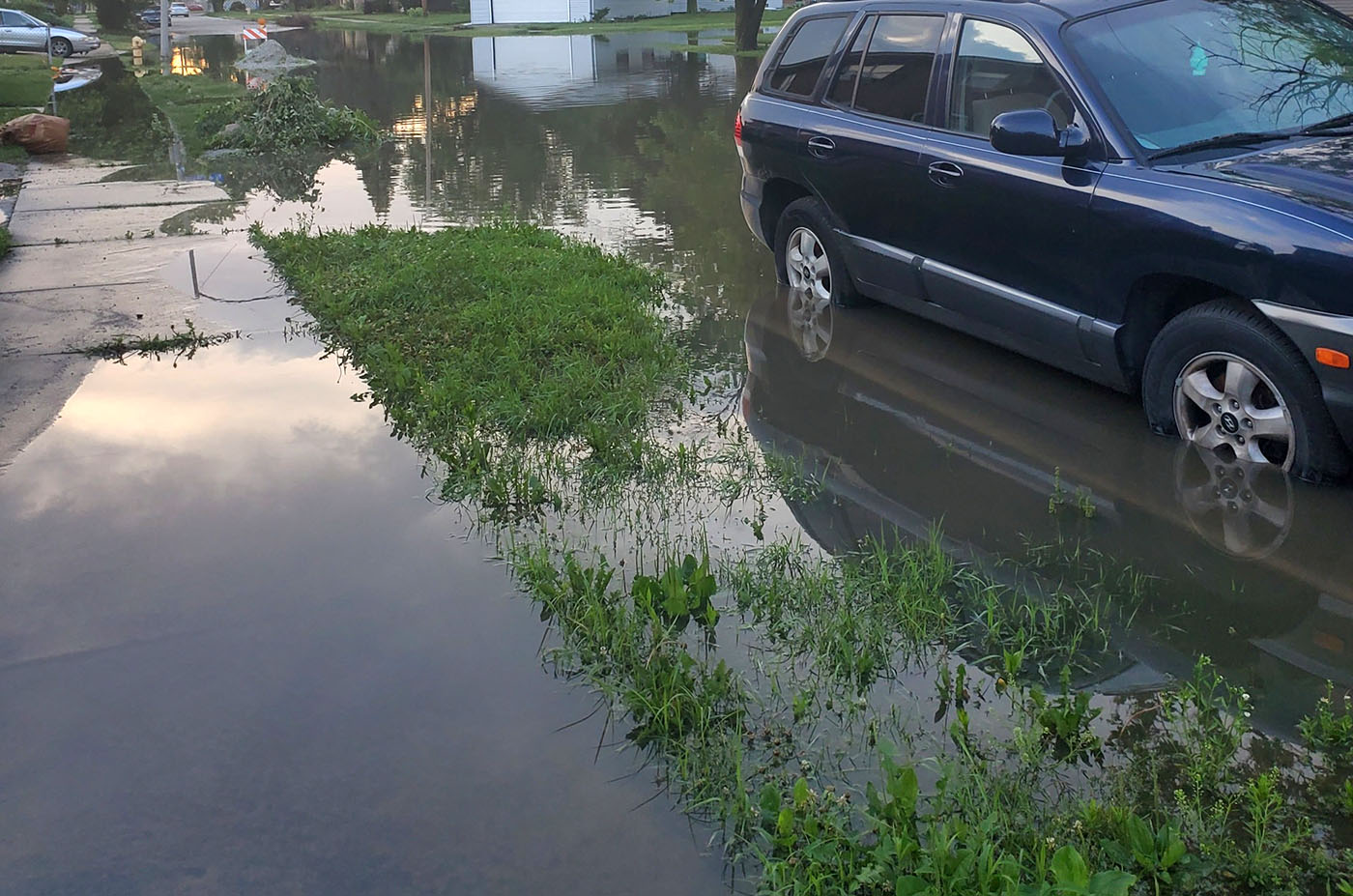
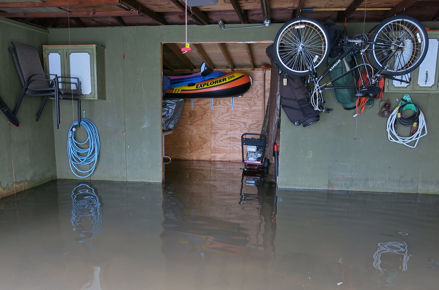
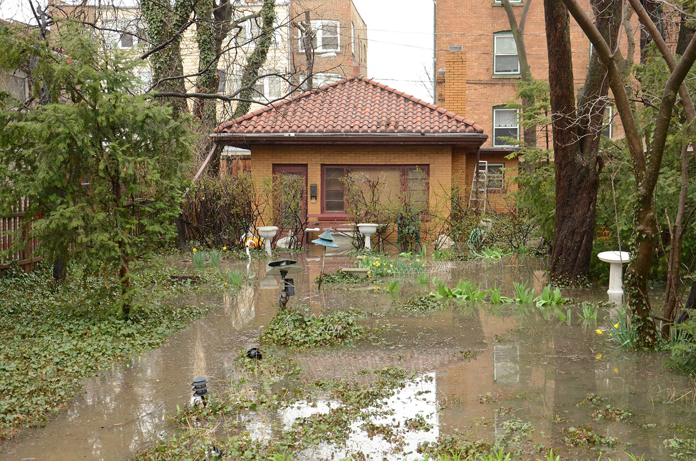
Flooding is an overflow of water (either rain or snowmelt) that accumulates on land that is typically dry. Water height can be anywhere from a few inches to multiple feet of water. The Calumet Region experiences both riverine flooding and urban flooding. Riverine flooding occurs when river levels rise above its edges and spill over. Urban flooding is when rain water accumulates on streets, sidewalks, and yards due to overwhelmed sewer systems and the lack of permeable (water-absorbing) land. Water can overflow and back up into homes, businesses, and roads.
The Calumet Region defined in this project is a broad 269 sq. Mile region in southern Cook County. It is located just South of Chicago and has a population of 1,086,382.
This study area was determined using the Metropolitan Water Reclamation District’s planning boundaries for Little Calumet River Watershed project, plus any municipal boundaries that intersected this area.
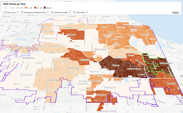
Click on the map to view communities of the Calumet Region, or pick from a list of communities in the study area to view maps & analysis of flooding data in the area.
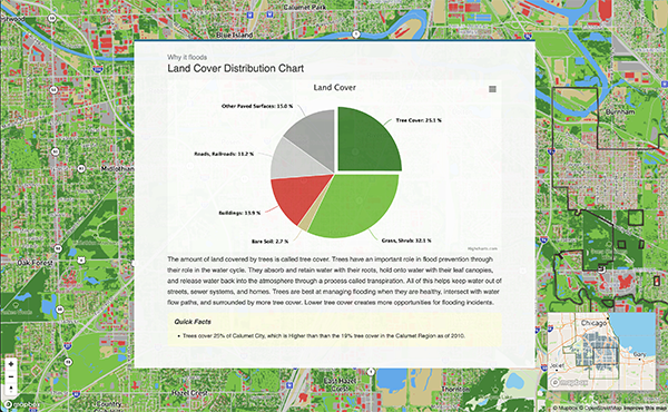
Historically, the Calumet Region was an area of prairies and wetlands, resulting from the glaciers that drained into what is today, Lake Michigan. As the United States developed industrial and suburban areas with more pavement, it eliminated much of the wetlands and prairies that absorbed and managed stormwater.
As climate change causes more frequent and heavier rain events, the rainwater cannot be absorbed because pavement is an impervious surface that water cannot filter through. Additionally, typical green lawns poorly absorb water, so all the surface water runs directly into sewer systems. The sewer systems then fill past their intended capacity, causing floods in streets, yards, and homes of Calumet Region neighborhoods.
There are four primary factors contributing to flooding in the Calumet Region:
When natural spaces like prairies and wetlands (which are considered to be pervious because they easily absorb stormwater) are replaced by impervious surfaces like parking lots and buildings, rainwater cannot be absorbed into the soil and be sent back into the atmosphere through plants. With nowhere else to go, the rainwater enters the sewer system.
The Calumet Region is significantly flatter when compared to surrounding regions in Cook and Will County, which is due to the glaciers melting into Lake Michigan around 16,000 years ago. This flat landscape can cause water to drain slowly and pool in residential and public spaces.
Northeastern Illinois has seen increasingly more severe rainstorms, particularly heavy and short storms. This trend is projected to continue as climate change worsens, causing more rain to fall over the course of the year, and more rain to enter sewer systems.
Many sewer systems within the Calumet Corridor were designed to hold a much smaller amount of rainwater hundreds of years ago, prior to increased built environments and climate change that causes frequent, heavy storms. Additionally, as sewer systems age and maintenance is postponed, pipes may collapse, crack, or clog, reducing local drainage capabilities.
Flooding impacts people by making it hard for them to get around in their neighborhoods, destroying property, increasing stress on people’s mental and physical health, and requiring some residents to move.
Between 2010 and 2020 the Calumet region had 753 NFIP flood insurance claims filed in the Calumet Region, averaging $5,490 per claim and a total insurance claim payout of over $4 million.
However, these impacts are not shared equally across the region. CNT’s research on equity and flooding in the City of Chicago has shown that BIPOC (Black, Indigenous, and people of color) and low-income communities are more impacted by flooding due to poorer economic and infrastructure conditions. This is a direct result of discriminatory policies and lending practices of the past and present.
“Sometimes the water gets two feet high in the streets and we have to move our cars or else they will get flooded”
— Dolton Resident
“When it rains real bad [sewage] comes up,” she said. A local contractor told her it would cost $10,000 to install a sump pump, “I wish I had known about all that before I bought here.”
— Calumet City Resident
“The water gets so high it floods the street, my yard, and comes in through my basement window”
— Blue Island Resident
of the population is low-income
of the population is BIPOC
Frequent, high-volume flooding can cause damage to the environment as well. Some of the environmental impacts include: poorer water quality resulting from polluted water runoff or sewer overflows, and ecosystem degradation. These environmental impacts also affect various outdoor recreational and tourist activities.
The Urban Flooding Baseline Tool seeks to inform community residents, and municipal and regional leaders that flooding is experienced across communities, not just within individual homes. The tool provides content knowledge to assist with community advocacy, municipal action, and regional stormwater planning efforts. Flooding is a reality, but communities can take steps to reduce the impact.
![]()
Analysis and web tool design by
Center for Neighborhood Technology
Released January, 2023
Explore the ‘Where’ and ‘Why’ of Urban Flooding, and Who Is Most Impacted